










California Wildfires Trigger Evacuations as Norte Fire Damages Homes and Interstate 5 Closures Disrupt US Travel
-
Travel, Weather
-
-
7 mins
-
Travel and Tour World
-
Ankita Neogi Khan
-

California wildfires threaten homes, trigger evacuations and disrupt travel across Orange County, Malibu and San Diego.
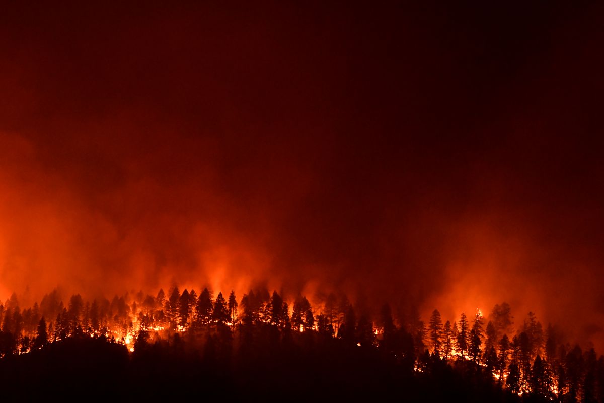
Southern California is facing a dangerous wildfire outbreak, with the Norte Fire in Orange County, the Bryson Fire near Malibu and the Henderson Fire near San Diego County threatening communities, highways and regional travel. The Norte Fire had burned 465 acres by Friday evening, with six homes damaged or destroyed and one firefighter suffering heat exhaustion. Meanwhile, the Bryson Fire had expanded to 147 acres, prompting evacuation orders across parts of the Santa Monica Mountains. The Henderson Fire had exceeded 2,000 acres, forcing repeated closures of Interstate 5. Strong Santa Ana winds, low humidity and temperatures approaching 95°F (35°C) are increasing risks for residents, motorists and visitors.
Three Fires Put Southern California on Alert
The fires are affecting three separate areas, creating a broad emergency for local communities and people travelling through Southern California. Although each incident has its own operational command, the shared weather conditions are complicating firefighting efforts.
CAL FIRE’s incident tracker recorded the Norte Fire at 465 acres, the Bryson Fire at 147 acres and the Henderson Fire at 2,080 acres. The agency’s published figures also showed different containment levels, underlining why travellers should assess each affected area separately.
| Fire | Location | Reported area burned | Key travel concern |
|---|---|---|---|
| Norte Fire | Orange County, near San Clemente and San Juan Capistrano | 465 acres | Evacuations, smoke and local traffic disruption |
| Bryson Fire | Near Encinal Canyon Road, Malibu | 147 acres | Evacuation orders and restricted access in the Santa Monica Mountains |
| Henderson Fire | Camp Pendleton, San Diego County | 2,080 acres | Interstate 5 closure and disruption to north–south journeys |
Incident figures reflect the supplied report and official incident updates available on 16 October 2026. Acreage, containment and restrictions can change quickly.
The Norte Fire has already damaged or destroyed six homes, according to the supplied report. One firefighter also suffered heat exhaustion, while crews continued to tackle the advancing flames.
In Malibu, the Bryson Fire prompted evacuation orders across parts of the Santa Monica Mountains. CAL FIRE identified Encinal Canyon Road as the incident’s location and listed evacuation orders and warnings in its updates.
The Henderson Fire presents a different challenge because it affects a major transport corridor. CAL FIRE reported that Interstate 5 was fully closed in both directions between Vandergrift Boulevard and Basilone Road during its 16 October update.
Santa Ana Winds Intensify Fire Danger
Santa Ana winds are a recurring feature of Southern California’s cooler months, commonly occurring between late September and May. These dry, often powerful winds can accelerate flames, carry embers ahead of the fire front and make aerial firefighting more difficult.
The immediate danger stems from the combination of strong winds, low humidity and dry vegetation. Even when firefighters contain part of a blaze, changing wind direction can expose new areas to flying embers or renewed fire activity.
The National Weather Service issued red flag warnings for several counties during the reported outbreak. Such warnings indicate weather conditions conducive to rapid fire growth, rather than confirmation that every location will experience a wildfire.
The supplied report also describes temperatures approaching 95°F (35°C) in Southern California. That level of heat adds another operational challenge for emergency personnel and increases the risk of heat-related illness among outdoor workers and evacuees.
For visitors, the weather creates several overlapping hazards. Smoke can reduce visibility, winds can affect driving conditions and emergency restrictions can change with little notice. Travellers should therefore treat official evacuation instructions as more important than previously confirmed hotel bookings or sightseeing plans.
Interstate 5 Closure Threatens Regional Journeys
Interstate 5 is one of the most important north–south road corridors on the US West Coast. It connects Southern California with destinations farther north and carries local traffic around communities, employment centres and visitor attractions.
The Henderson Fire’s impact on this route could affect more than motorists travelling directly to Camp Pendleton. Depending on the duration and extent of closures, diversions can add journey time, increase congestion on alternative roads and complicate access to accommodation or connecting transport.
The California Department of Transportation’s road-condition service reported an I-5 closure associated with wildfire activity on 16 October. It advised motorists to use an alternative route.
| Travel component | Potential effect | Recommended response |
|---|---|---|
| Interstate 5 journeys | Closures, diversions and longer driving times | Check Caltrans conditions before departure |
| Coastal road trips | Smoke, reduced visibility and emergency access restrictions | Follow official traffic instructions and avoid closed roads |
| Airport transfers | Delays if access roads or connecting highways are affected | Allow extra time and confirm the route with the transport provider |
| Hotel arrivals | Late check-ins or changes to planned arrival times | Contact the property before travelling through an affected area |
| Outdoor excursions | Temporary access restrictions or cancellation | Confirm local advisories before setting out |
These are potential consequences, not confirmation that every listed service or journey has been disrupted. The actual effect depends on the location of the fire, the road network and the duration of emergency restrictions.
Travellers should also avoid assuming that a road has reopened simply because traffic appears to be moving nearby. Fire crews may need access for equipment, water supplies and emergency vehicles. Official road updates provide a more reliable basis for route decisions.
Evacuation Orders Override Holiday Plans
The evacuation orders around Malibu and Orange County carry immediate implications for residents, hotel guests and people visiting coastal attractions. An evacuation order means people must leave the designated area, while an evacuation warning signals a potential threat and the need to prepare.
The distinction matters for visitors who may not recognise local road names or evacuation-zone boundaries. A hotel confirmation does not guarantee that the surrounding area remains accessible, and a familiar sightseeing route may become restricted during an emergency.
CAL FIRE’s Bryson Fire updates list evacuation zones and identify designated shelter arrangements. However, visitors must consult the latest local authority information rather than relying on an earlier incident bulletin.
People staying in affected areas should keep essential documents, medication, mobile phones and charging equipment accessible. They should also follow instructions from emergency personnel and leave promptly when ordered.
Visitors who require assistance should contact local emergency services or the relevant accommodation provider. Those outside the evacuation zones should still avoid approaching fire areas to watch the response or take photographs, as doing so can obstruct emergency operations.
What Travellers Should Check Before Departure
The outbreak demonstrates why travel planning during periods of elevated fire danger requires more than checking the weather forecast. Conditions can change between booking a journey and reaching the affected region, especially when winds are strong.
Before travelling, visitors should review three essential sources: CAL FIRE for incident information, the National Weather Service for weather warnings and Caltrans for road conditions. Local sheriff’s departments and emergency-management agencies are also important sources for evacuation boundaries and shelter instructions.
Official information is particularly valuable for international visitors, who may be unfamiliar with California’s emergency-alert systems. Travellers should ensure their phones can receive local alerts and should keep accommodation details available offline if mobile connectivity becomes unreliable.
A practical distinction is necessary between a weather warning and a travel restriction. A red flag warning signals heightened fire danger, but it does not automatically mean every road or attraction is closed. Conversely, an area can become inaccessible because of an evacuation order even if the nearest weather station reports improving conditions.
Tourism Businesses Face Operational Pressure
Southern California’s tourism economy spans coastal accommodation, restaurants, outdoor recreation, cultural attractions and transport services. Wildfires can affect these businesses even when flames remain outside major visitor districts, particularly when road closures or evacuation orders interrupt access.
For hotels, the immediate priorities include guest safety, staff availability and reliable information about access routes. Properties near affected areas may need to accommodate early departures, extend stays for stranded guests or coordinate alternative arrangements. These are potential operational responses, not confirmed measures taken by individual businesses.
Tour operators and transport providers also face uncertainty. Outdoor excursions may become unsuitable because of smoke, heat or changing access restrictions. Meanwhile, road diversions can disrupt scheduled transfers and reduce the time available for planned activities.
The California wildfires also highlight the importance of flexible booking policies during emergencies. Travellers should check cancellation terms, insurance coverage and the conditions governing changes caused by evacuation orders or transport closures. Coverage varies by policy, so visitors should not assume every wildfire-related expense qualifies for reimbursement.
| Tourism sector | Business exposure | Operational priority |
|---|---|---|
| Hotels and resorts | Restricted access, guest relocations and uncertain arrival times | Communicate safety information and review booking arrangements |
| Tour operators | Cancelled excursions and inaccessible destinations | Check local advisories before departures |
| Car hire and transfers | Road closures and longer journeys | Verify routes and communicate delays |
| Restaurants and attractions | Reduced visitor access and staffing pressures | Follow local restrictions and assess safe operating conditions |
| Travel advisers | Rapidly changing destination information | Provide verified updates and flexible alternatives |
For the wider travel industry, the episode reinforces a key lesson: destination accessibility is as important as destination demand. Even a popular coastal itinerary can become impractical when emergency services restrict roads or authorities order evacuations.
Lessons From California’s Wildfire History
California has experienced destructive wildfires during multiple seasons, including major incidents around Los Angeles in recent years. The recurrence of these emergencies has increased the importance of evacuation readiness, public warning systems and coordination between fire services and transport authorities.
The 2018 Woolsey Fire, which affected Malibu and surrounding communities, remains a significant example of how wildfires can disrupt populated areas and regional travel. However, the present fires should not be treated as equivalent in scale or eventual impact. Their outcomes will depend on containment, weather, the number of structures exposed and the effectiveness of emergency operations.
A useful comparison is the difference between a routine travel disruption and a wildfire emergency. Ordinary congestion may require a revised departure time, whereas an evacuation order demands immediate compliance. Travellers must not treat the two situations as interchangeable.
California’s current incident reporting also illustrates why figures need timestamps. Acreage, containment and closure information can change within hours. A report published in the morning may no longer describe conditions accurately by the afternoon.
For publishers and travel businesses, the most responsible approach is to distinguish confirmed information from projections. Reported damage should not be expanded into unsupported claims about total losses, and a temporary closure should not be described as permanent. Such precision helps readers make better decisions while preserving confidence in travel information.
What the Fires Mean for Visitors
The immediate outlook for Southern California travel depends on firefighting progress, wind conditions and decisions by local authorities. Although the reported Santa Ana winds were expected to ease after their Friday peak, improving weather alone would not guarantee that affected roads or communities could reopen safely.
Visitors with upcoming trips should reassess routes, accommodation access and outdoor activities before departure. Those already in the region should follow official instructions, avoid fire-affected areas and remain prepared for sudden changes.
The California wildfires are a reminder that travel plans must remain adaptable during fast-moving emergencies. For the tourism industry, accurate communication and clear contingency arrangements can reduce confusion without compromising public safety. Ultimately, emergency instructions must take precedence over sightseeing, reservations and travel schedules. Travellers should rely on current official updates rather than older reports or unverified social media posts.
The post California Wildfires Trigger Evacuations as Norte Fire Damages Homes and Interstate 5 Closures Disrupt US Travel appeared first on Travel and Tour World