










Tropical trouble shifts closer to home as Invest 92L is likely to drench parts of the Gulf Coast
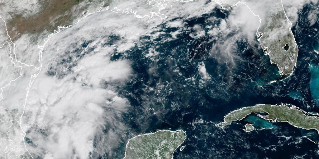

An invest has been designated in the southern Gulf amid the quietest start to an Atlantic hurricane season since the start of the satellite era (1966), with no hurricanes having formed this year.
THE TAKEAWAY
An invest has been designated in the southern Gulf amid the quietest start to an Atlantic hurricane season since the start of the satellite era (1966), with no hurricanes having formed this year.
The National Hurricane Center (NHC) has designated a brewing tropical disturbance as Invest 92L, and the storm is likely develop in the Bay of Campeche later this week.
WHAT IS AN INVEST DURING HURRICANE SEASON?
The term "invest" is used every hurricane season in the Atlantic and the Eastern and Central Pacific basins, accompanied by a number from 90 to 99 and either the suffix "L," "E" or "C," respectively.
The odds of development continue to increase, with a 60% chance in two days and an 80% chance of developing within a week, respectively.
A massive cold front is draped over Central Florida and is extending across the Gulf, bringing days of heavy rain to the Sunshine State through the workweek.
A storm could develop at the tail end of this front sometime on Thursday or Friday, potentially developing a more defined center that forecasters can track.
CALIFORNIA DECLARES STATE OF EMERGENCY AS POTENTIALLY HISTORIC SUPER EL NIÑO LOOMS
Regardless of tropical development, forecasts show the front’s remnants lifting north toward the end of the workweek, potentially bringing another round of heavy rain to parts of the Florida and Louisiana coasts by the weekend.
Computer forecast and AI models have yet to agree on whether a system will form at all and, if it does, where it will form, how it will track or whether it will become tropical.
As FOX Weather Hurricane Specialist Bryan Norcross frequently notes, forecasts for developing systems are always subject to large errors.
The FOX Forecast Center said the system could also struggle to develop or remain closer to the coast of Mexico.
The FOX Forecast Center notes that even if the system intensifies into a named tropical system, it is unlikely to strengthen into a powerful hurricane.
However, people along the Gulf Coast should still be aware of the potential for flooding and damaging wind gusts. Even weaker tropical systems can produce devastating impacts.
THE LATEST FROM FOX WEATHER HURRICANE SPECIALIST BRYAN NORCROSS
Meanwhile, Gulf water temperatures are currently at their warmest levels on record dating back to 1982. Warm waters are conducive for tropical development.
The Atlantic has gone more than 330 days since the last hurricane formed, with September ending without a hurricane for the first time in 32 years.
It marked only the eighth time since the 1950s that the Atlantic went through September without a hurricane and just the second time since the start of the satellite era in 1966.
Despite it being the climatological peak of the season, El Niño-driven winds have suppressed activity this year.
If the entire 2026 Atlantic hurricane season ends without a hurricane, it would be just the third time on record, since 1914 and 1917.
However, hurricanes may have formed during those seasons, but went undetected because they remained far from land and ships at sea.
If this happens in 2026, it would mark the first hurricane-free Atlantic season of the modern satellite era.
Stay with FOX Weather for the latest.
The post Tropical trouble shifts closer to home as Invest 92L is likely to drench parts of the Gulf Coast appeared first on Fox Weather