



Tropical Storm Bertha barrels towards second landfall over Texas with worst conditions imminent
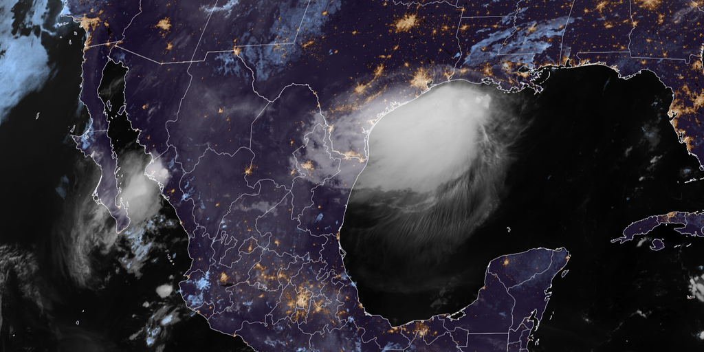

Tropical Storm Bertha is back in the northern Gulf and racing toward Texas, where it is expected to make a second landfall Thursday afternoon after striking southeast Louisiana on Wednesday.
NEW ORLEANS — Tropical Storm Bertha is back in the northern Gulf and racing toward Texas, where it is expected to move over the Lone Star State, and bring the worst conditions imminently.
Bertha has weakened slightly as it lashes parts of the southwestern Louisiana and Upper Texas coasts with tropical-storm-force winds and coastal flooding.
HURRICANE SEASON 2026: THESE ARE THE STORM NAMES YOU'LL SEE THIS SEASON
Bertha was about 35 miles south of Lake Charles, Louisiana, with maximum sustained winds of 45 mph, and is moving west at 10 mph.
The storm remains lopsided, meaning that most of its rain and storms are pushed to one side. This structure will prevent significant strengthening, according to the FOX Forecast Center.
Bertha is tracking generally toward Galveston, Texas and places south.
"If the structure of Bertha can remain even somewhat organized, a 3-6 hour window exists for somewhere between Matagorda Bay and perhaps Corpus Christi for very heavy rain," the FOX Forecast Center said.
Tropical Storm Bertha made an initial landfall in St. Bernard Parish, Louisiana around 2:00 p.m. local time on Wednesday.
It's the first named storm to make landfall in Louisiana since Hurricane Francine struck in September 2024 and just the 10th tropical cyclone to make landfall in the state during the month of July since reliable records began in 1850.
FOX Weather Correspondent Brandy Campbell reported gusty winds along the beach in Biloxi, Mississippi as Bertha's center tracked into southeastern Louisiana.
TRACK BERTHA: LIVE RADAR, FLOOD THREAT, WIND SPEED AND RADAR
FOX Weather Senior Correspondent Robert Ray experienced rough surf and 40 mph wind gusts on Dauphin Island, Alabama, early Wednesday.
Bertha moved over the uninhabited Chandeleur Islands, a set of barrier islands that mark the easternmost point of Louisiana, on Wednesday morning.
Tropical Storm Warnings are in effect along the northern Gulf Coast from Morgan City, Louisiana to Sargent, Texas.
According to the FOX Forecast Center, winds could gust as high as 50 mph along the Texas Coast Thursday afternoon but are expected to quickly decrease after the storm moves ashore.
WHAT HURRICANE AND TROPICAL STORM WATCHES AND WARNINGS MEAN
Coastal Flood Advisories remain in effect for much of the northern Gulf Coast through Thursday morning.
The National Hurricane Center said storm surge combined with high tide could bring water levels between 1 and 3 feet above normally dry ground along the coast from Mississippi to Port Bolivar, Texas.
Bertha will also continue to bring life-threatening rip currents along the northern Gulf Coast, as well as parts of the Florida Gulf Coast.
The FOX Forecast Center said Bertha reached peak intensity Tuesday as a moderate tropical storm, with the heaviest rain staying offshore.
Meanwhile, the Forecast Center said there is a limited window for remaining rain.
"If Bertha does maintain as a low-end to moderate tropical storm, it could sustain a nasty pocket of intense thunderstorms," the Forecast Center said.
"Rain rates could exceed 2-3 inches per hour during this time."
The storm is expected to dissipate quickly Thursday evening as it moves over land, with only a few remnant showers remaining Friday.
Bertha formed Monday in the northeastern Gulf, becoming the second named storm of the Atlantic hurricane season.
This story is developing. Check back for updates.
The post Tropical Storm Bertha barrels towards second landfall over Texas with worst conditions imminent appeared first on Fox Weather