








Timeline: Where and when you will see impacts from the strengthening nor'easter this weekend
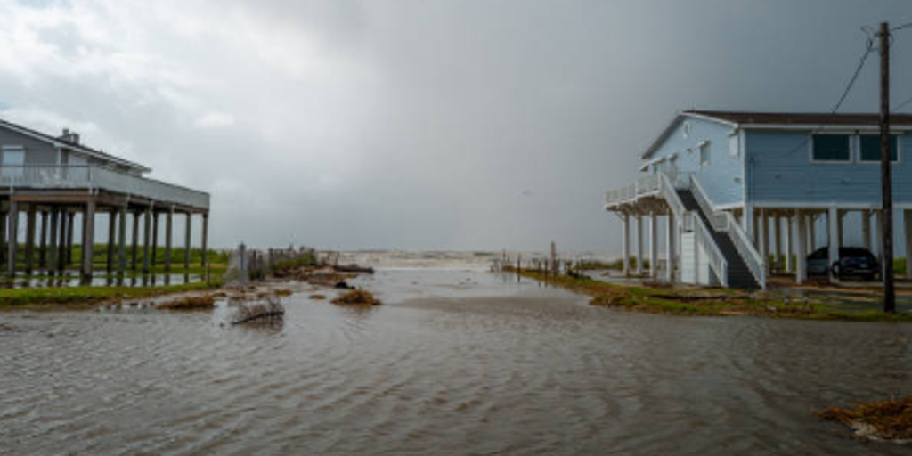


A strengthening nor'easter is threatening millions as it begins its charge up the East Coast, lashing North Carolina's Outer Banks and the Mid-Atlantic coast with more intense wind, severe beach erosion and high tide flooding.
THE TAKEAWAY
A strengthening nor'easter is threatening more than 40 million people as it begins its charge up the East Coast, lashing North Carolina's Outer Banks and the Mid-Atlantic coast with more intense wind, severe beach erosion and high tide flooding.
See when and where the worst impacts will be:
THE LATEST FROM FOX WEATHER HURRICANE SPECIALIST BRYAN NORCROSS
The storm is expected to intensify as it tracks north along the coast through the weekend, bringing prolonged rain, strong winds and coastal flooding through the weekend, with the potential for power outages across impacted areas from North Carolina to Maine, particularly for communities closest to the coast.
TROPICAL STORM FAY KEEPS CHURNING IN ATLANTIC, BUT ITS SHOT AT BECOMING A HURRICANE IS FADING
Impacts: The nor'easter will continue to consolidate and intensify as it moves from east of the Outer Banks to east of the Delmarva Peninsula. Winds will increase along the Mid-Atlantic to New England coasts, and the first rain will begin to fall during the evening hours.
Impacts: Peak Nor'easter conditions, heavy rain bands, high winds, and severe coastal flooding erosion.
Heavy rain will soak much of the Northeast through the evening as the storm stalls.
WHERE DO ANIMALS GO WHEN FALL ARRIVES? INSIDE THE INCREDIBLE MIGRATIONS HAPPENING ACROSS THE US
Impacts: The Nor'easter will slingshot toward the Jersey shore. Strong winds will blast the Tri-State area, southeast New England, and even as far north as Vermont and New Hampshire. The storm will rapidly weaken, and the winds will drop during the afternoon. By Sunday night, most areas will see wind gusts drop below 40 mph. Rain will continue to fall all day and night across the Northeast.
A Level 2 out of 4 flash flood threat covers much of the New England coast through Monday.
Impacts: Storm weakening, clearing inland conditions, and lingering high surf.
New Jersey & NYC: After moving into New Jersey on Sunday night, the storm will rapidly weaken before looping back over the waters between New Jersey and Long Island on Monday. The weakened system will continue to produce light rain across the Northeast, but the winds will be much weaker than they were over the weekend. Max gusts will be in the 20–30 mph range. The last high-tide cycle to feature coastal flooding is also expected on Monday.
New England: Coastal waters and beaches will see slowly subsiding seas, though rough surf, beach erosion, and minor residual high-tide flooding will take a couple of days to fully clear. Persistent light rain will continue to pinwheel around the Nor'easter.
On Tuesday, what's left of the storm will spread light rain into northern New England while the Mid-Atlantic and Tri-State Area dry out.
The post Timeline: Where and when you will see impacts from the strengthening nor'easter this weekend appeared first on Fox Weather