 Alexa+ Free with Prime get Nikki")


 hotels.com - US - Big Spring Sale")


Timeline: When you will see first impacts from the historic blizzard nor'easter ‘bombing out’ in the Northeast
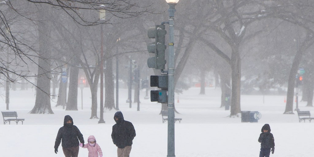
A highly impactful nor'easter is forecast to bring blizzard conditions to the Northeast beginning Sunday, with snow totals forecast at over a foot. We're letting you know when to expect the worst impacts in your area.
A highly impactful nor'easter is forecast to bring blizzard conditions to the Northeast beginning Sunday, with snow totals forecast at over a foot. We're letting you know when to expect the worst impacts in your area.
Blizzard Warnings are in place beginning Sunday morning, with New York City and the New Jersey coastline included.
Winter Storm watches and warnings are in effect for Boston, Philadelphia, Washington, D.C. and Baltimore as well.
Snow forecasts have increased yet again, now making the brewing storm one of the biggest snowstorm threats in years for major Northeast cities like New York City.
LIVE UPDATES: HISTORIC BLIZZARD TARGETS MILLIONS IN THE NORTHEAST WITH BLINDING SNOW, INTENSE WINDS
Here is a timeline of when and where this nor'easter will arrive in your area and what forecasts expect it to deliver:
Light snow will be falling across the interior Northeast and New York City, separate from the blockbuster storm headed into the region.
This snow will leave a light coating on the ground and wrap up by mid-morning, according to the FOX Forecast Center.
Rain will just be shifting to snow in Washington, D.C.
NOR'EASTER BOMB CYCLONE TRACKER: LIVE RADAR, SNOW FORECAST, WINTER ALERTS, WIND GUSTS AND MORE
By Sunday afternoon, the storm will start to come together as an area of low pressure moves off the coast of North Carolina and rapidly strengthens.
As it does so, precipitation will begin concentrating heavily over the Mid-Atlantic. Circulation around the low pressure will pull cold air toward the coast, quickly changing the rain over to snow, according to the FOX Forecast Center.
Snow will push into the Northeast in cities like New York, Washington, D.C. and Philadelphia in early afternoon.
By the time the sun sets on Sunday, the storm will intensify significantly off the coast as its central pressure rapidly drops.
The storm will "bomb out" as the pressure drops more than 24 millibars in 24 hours and goes through bombogenesis.
The heaviest snow starts overnight for the Northeast.
The further inland, the less snow likely to be received as this storm tracks dangerously close to the East Coast.
Heavy snow and gusty winds of 50+ mph will lead to blizzard conditions in New York City.
Dangerous travel conditions will be expected.
Coastal communities in Massachusetts are likely to see coastal flooding overnight Sunday into Monday morning as well.
Things will start getting messy in New England on Monday as classic nor'easter conditions set in with heavy snow and powerful winds.
Blizzard conditions will be highly possible across southeast Massachusetts and Rhode Island.
While it remains uncertain if Boston will see official blizzard conditions, the possibility certainly exists and should be prepared for, the FOX Forecast Center said.
Widespread power outages will be possible from the winds, which could violently gust as high as 70 mph.
Snow will come to an end in New York City and areas west on Monday afternoon.
For Long Island and areas to the North of New York City up into Maine, snow will continue until Monday evening.
Coastal erosion and flooding will remain a concern through Monday.
The snow and storm will be over for everyone by Tuesday morning.
The post Timeline: When you will see first impacts from the historic blizzard nor'easter ‘bombing out’ in the Northeast appeared first on Fox Weather


