










Timeline: When will dangerous, tropically enhanced flooding reach the Southwest, Southern Plains and Midwest?


A dangerous multiday flood event is developing across the Four Corners, Southwest, and Plains this week as tropical moisture from Hurricane Polo, which is set to make landfall in Baja California, and the remnants of Odalys spread northward through the week.
THE TAKEAWAY
A dangerous multiday flood event is developing across the Four Corners, Southwest and Plains this week as tropical moisture from Hurricane Polo, which is set to make landfall in Baja California, and the remnants of Odalys spread northward through the week.
Monday will mark the first of five consecutive days in which NOAA's Weather Prediction Center (WPC) has issued Level 3 out of 4 flash flood risk. Flood Watches have been issued across nine states, including all of New Mexico through Tuesday.
Up to 20 states could see impacts from this weather system this week.
This comes amid an active monsoon season across the Southwest, which has seen deadly flooding across parts of New Mexico and Grand Canyon National Park. Several prior tropical systems have enhanced flooding across the region this season.
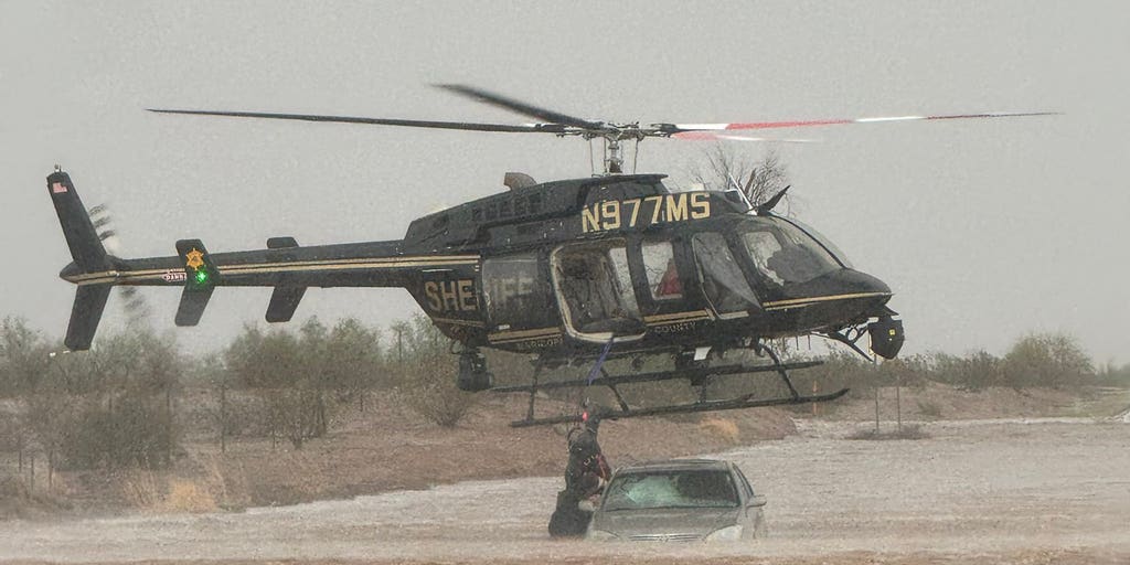
WATCH: RESCUES UNFOLD IN NEW MEXICO AS HURRICANE POLO MOISTURE FUELS STATEWIDE FLOOD THREAT
On Monday, one of the first major concerns will be a Predecessor Rain Event (PRE) developing ahead of the main storm system. A PRE is a band of heavy rain that forms well ahead of a tropical system when deep tropical moisture is pulled northward and interacts with a stalled or slow-moving boundary.
In this case, moisture from Polo will surge into the Southwest while an upper-level trough approaches from the west, creating a setup favorable for prolonged heavy rainfall before the main system arrives.
Heavy rain will already be ongoing across southern California and Arizona, spreading into New Mexico, Utah and Colorado, with 1 to 2+ inches possible and locally higher amounts. Areas around Ruidoso, burn scars, desert washes and the Grand Canyon will be especially vulnerable.
GRAND CANYON FACES LONG ROAD TO RECOVERY AS NATIONAL PARK SERVICE UNVEILS PLAN AFTER DEADLY FLOODING
On Tuesday, the threat expands into eastern New Mexico and the Texas and Oklahoma Panhandles as Polo's remnants move into the Southwest.
Rainfall rates could exceed 1 to 2 inches per hour, with more than 3 inches possible across parts of the panhandles and locally 3 to 6+ inches in the heaviest-hit areas.
If the area covered by Tuesday's Level 3 flash flood risk was a state, it would be the third largest in the country behind Alaska and Texas.
SEE IT: POWERFUL NOR’EASTER UNEARTHS 19TH-CENTURY SHIPWRECK ON NEW ENGLAND SHORE
By Wednesday and Thursday, the flood threat shifts farther east across the Plains and Texas as tropical moisture becomes part of a larger storm system.
Heavy rain will spread from Texas and Oklahoma toward the Midwest, with Dallas, Oklahoma City and the Texas Hill Country among the areas facing significant rainfall. Another 2 to 3 inches could fall in parts of Texas each day.
It is quite rare for the Weather Prediction Center (WPC) to issue a flood threat this high this far in advance. The WPC only issues their outlook for up to five days and to get a Level 3 out of 4 on day 5 is very rare. It has happened only a handful of times since 2021.
Another remarkable stat is that Dallas has not seen measurable rain (at least 0.01") since July 16. And now, Dallas is centered in what could be a significant flood threat starting Wednesday within the Level 3 out of 4 threat zone.
EL NIÑO JUST BROKE A HISTORIC TEMPERATURE RECORD — AND IT’S STILL INTENSIFYING
By late week, widespread heavy rain could stretch from the Texas-Mexico border to the Great Lakes. Many areas throughout the week could receive 6 to 8+ inches for the event, with higher totals where thunderstorms repeatedly track over the same locations.
Julian Atienza contributed to this story.
The post Timeline: When will dangerous, tropically enhanced flooding reach the Southwest, Southern Plains and Midwest? appeared first on Fox Weather