



Severe storms to trigger multiday flood threat across Mid-Atlantic, Carolinas as Bertha nears Gulf Coast
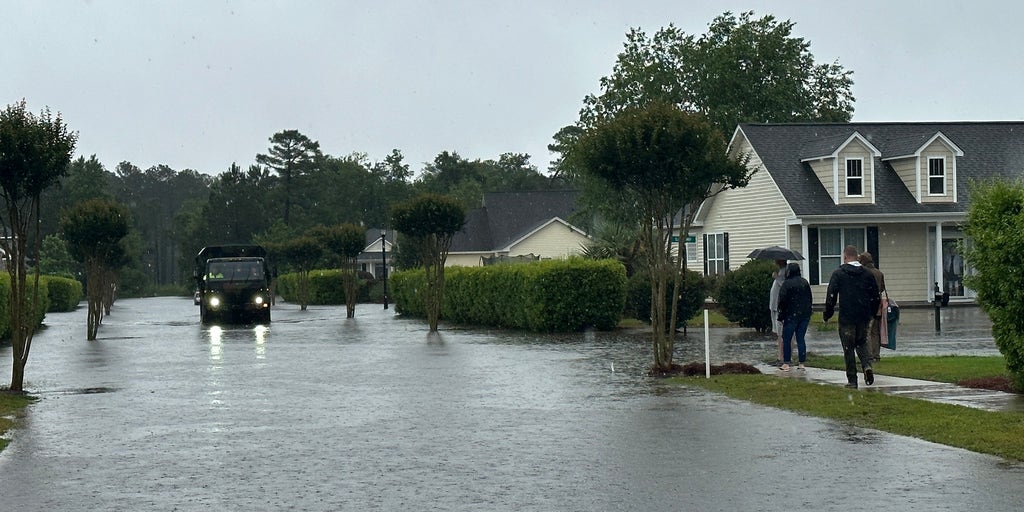


A cold front is expected to bring severe thunderstorms capable of producing damaging wind gusts to parts of the Mid-Atlantic and the Carolinas on Wednesday. Afterward, the front is expected to stall and draw moisture from the Gulf, potentially enhanced by Tropical Storm Bertha, bringing repeated rounds of rain and a mulitday flash flood threat.
A cold front is expected to bring severe thunderstorms capable of producing damaging wind gusts to parts of the Mid-Atlantic and the Carolinas on Wednesday. Afterward, the front is expected to stall and draw moisture from the Gulf, potentially enhanced by Tropical Storm Bertha, bringing repeated rounds of rain and a multiday flash flood threat.
LATEST ON TROPICAL STORM BERTHA
NOAA’s Storm Prediction Center (SPC) has issued a Level 2 out of 5 risk of severe thunderstorms beginning Wednesday afternoon for northern North Carolina, Eastern Virginia and parts of the Delmarva, with the primary threat being damaging winds gusts.
This threat covers Raleigh, North Carolina, Virginia Beach, Virginia, and Salisbury, Maryland.
A broader Level 1 threat includes New Jersey, Washington, D.C., central Virginia, Western and southern North Carolina, as well as parts of northwestern South Carolina.
However, the FOX Forecast Center said the main concern will be flash flooding, especially as the cold front slows down near the Carolinas and taps into increasing moisture from Tropical Storm Bertha in the Gulf. Exactly how much moisture Tropical Storm Bertha will provide will depend on where the storm tracks.
Repeated rounds of heavy rain are expected from Wednesday through at least Friday.
Eastern North Carolina is expected to see the highest rain totals, while the mountains of Western North Carolina are not expected to see significant impacts.
KNOW YOUR FLOOD TERMINOLOGY: WHAT FLOOD WATCHES, WARNINGS AND EMERGENCIES REALLY MEAN
Raleigh, areas eastward toward the Outer Banks, and locations along the coast are in the bull's-eye of the greatest flood risk. The threat will extend south toward Wilmington, North Carolina, and north toward Virginia Beach.
Some areas in Eastern North Carolina could receive more than 8 inches of rain between Wednesday and Saturday. A widespread 2-3 inches of rain is expected across the region.
Currently, the flood threat is at a Level 2 out of 4, but the FOX Forecast Center said it could be upgraded to a Level 3 out of 4 depending on how Bertha develops and how much moisture it brings into the region.
TRACK TROPICAL STORM BERTHA: LIVE RADAR, FORECAST CONE AND WARNINGS
By the end of the week, the front is expected to drift farther south, shifting the heaviest rainfall closer to the coast. This could improve conditions inland while moving the flood threat from the Outer Banks toward coastal South Carolina.
Stay with FOX Weather for the latest updates.
The post Severe storms to trigger multiday flood threat across Mid-Atlantic, Carolinas as Bertha nears Gulf Coast appeared first on Fox Weather