


 Classic designer bags")


 Summer of Soccer")


Severe storms target Northern Plains with powerful winds, large hail threat heading into workweek
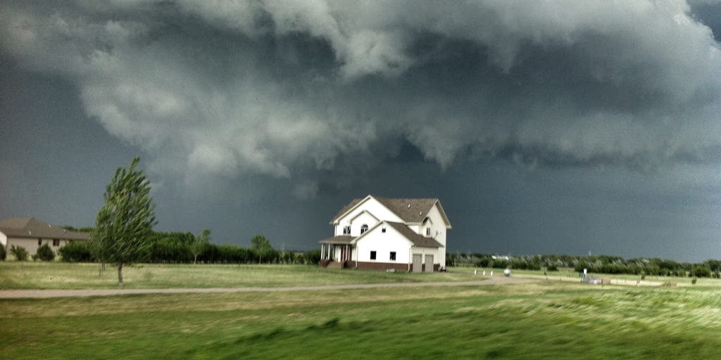
The Northern Plains are set to be rocked by severe weather for a few days in a row, as storms charge up to bring very strong, gusty winds and large hail into Monday.
The Northern Plains are set to be rocked by severe weather for a few days in a row, as storms charge up to bring very strong, gusty winds and large hail into Monday.
According to the FOX Forecast Center, storms will really power up in the late afternoon and evening hours across Nebraska, North and South Dakota, Montana and Wyoming.
A Level 2 out of 5 severe storm threat is in effect for Sunday in portions of North Dakota and Minnesota, where damaging wind gusts and large hail are likely to materialize later in the day.
Grand Forks and Fargo, North Dakota, are both in the level 2 zone.
According to the FOX Forecast Center, a shifting pattern will send powerful, fast-moving winds into a moisture-rich environment, creating the setup for severe weather that could last through Monday.
ILLINOIS LEADS THE COUNTRY FOR MOST TORNADO REPORTS SO FAR IN 2026 AND IT'S ONLY JUNE
Widespread coverage of severe storms is not guaranteed, the FOX Forecast Center said, due to an atmospheric "cap," which could suppress thunderstorm development despite a heavily primed environment with plenty of instability for storm formation.
Some storms will ripple through the area, but the timing and severity will depend on if this atmospheric cap can be breached.
On Monday, extreme heat and severe weather will target Minneapolis, creating massive instability, which allows storms to thrive.
HERE ARE 8 OF THE BIGGEST WEATHER MYTHS EXPLAINED
The FOX Forecast Center said that while the strong atmospheric cap may initially suppress widespread daytime storms, any cell that manages to break through this cap will rapidly intensify.
Like Sunday's storms, Mondays will carry a substantial risk for damaging wind gusts, large hail and localized flash flooding across the Minneapolis metro area.
SNOW, SLEET, FREEZING RAIN AND HAIL: WHAT'S THE DIFFERENCE?
The atmosphere will be moisture-rich, with dew points surging into the upper 60s and lower 70s ahead of the advancing area of low pressure.
Isolated flash flooding will remain a threat across portions of the Northern Tier through Sunday, where there is currently a Level 1 out of 4 flash flood threat in place.
By Tuesday, storms will have moved out of the region.
Stay with FOX Weather for the latest forecasts as severe storms ramp up.
The post Severe storms target Northern Plains with powerful winds, large hail threat heading into workweek appeared first on Fox Weather


