


 Summer of Soccer")


Millions in the Plains see large hail and tornadoes return to Kansas, Oklahoma
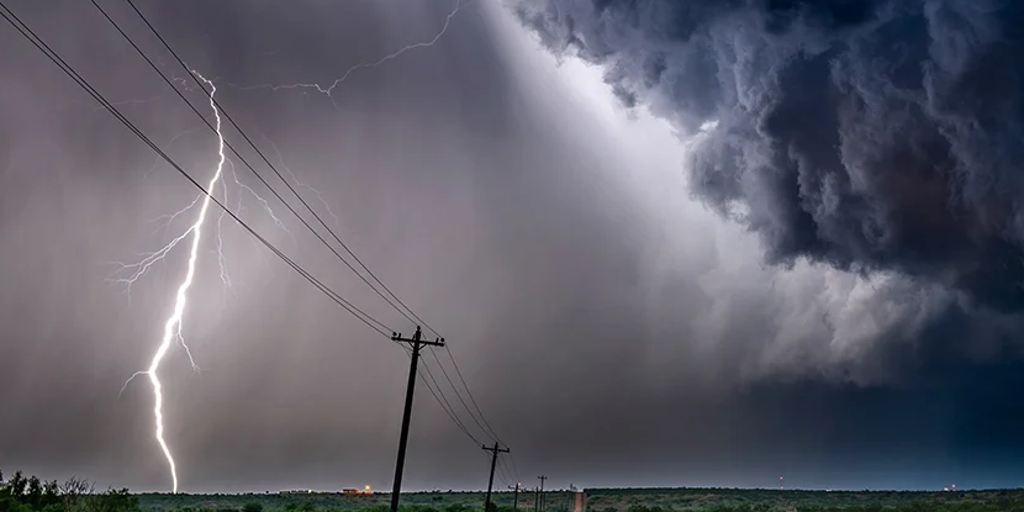
More than 30 million Americans are once again in the path of dangerous severe weather with large hail, damaging winds, and tornadoes all possible in the threat zone.
More than 30 million Americans are once again in the path of dangerous severe weather. As we continue into the overnight hours, the central and southern Plains are seeing large hail, damaging winds and tornadoes.
Huge hailstones exceeding two inches in diameter and strong EF-2+ tornadoes are possible.
Parts of Kansas, Nebraska and Missouri are under a Level 3 out of 5 severe storm threat, while a broader Level 2 risk extends into surrounding areas, including Oklahoma.
This comes as 28 tornadoes have been confirmed across parts of the South and central U.S. since Thursday, including a monstrous EF-4 that tore through Enid, Oklahoma.
Significant damage was reported on the city’s southern side, particularly in Gray Ridge, where at least 40 homes were confirmed damaged on Friday.
Across Texas, severe storms also caused widespread structural damage in multiple neighborhoods, leaving at least 20 families displaced, numerous injuries, and two confirmed deaths, officials said.
LEVEL 4/5 RISK: GIANT HAIL, STRONG TORNADOES TARGET PLAINS AGAIN AS DANGEROUS SEVERE STORMS FIRE UP
The first half of Sunday was pretty quiet across the Plains as leftover storms from Saturday weakened across Arkansas, Louisiana, and Texas.
A few storms with big hail and strong winds have already popped up in Oklahoma and Kansas.
Storm coverage increased during the evening as mid-level jet stream max moved over the region, increasing lift. Into the overnight period, powerful storms will likely be ongoing somewhere in Kansas, southern Nebraska or western Missouri.
Strong tornadoes are possible, along with very large hail and over 60 mph wind gusts.
Down across Oklahoma, extreme atmospheric energy built in the wake of Saturday's storms. However, a capping inversion acted as a lid and kept storms from forming for most of the day, before eroding in the evening as low-level moisture increased.
NORTHEAST TO SEE SOGGY WEEKEND AS MUCH-NEEDED RAIN HELPS EASE DROUGHT CONDITIONS
As the evening transitioned into the late-night hours, the risk becomes more serious as the storms started to tap into the air at ground level.
Once these storms become surface-based, the potential for tornadoes increased significantly, with the possibility of one or two strong tornadoes developing after dark, the FOX Forecast Center said.
SEE IT: DESTRUCTIVE TORNADOES RIP ACROSS NORTHERN OKLAHOMA, LEAVING WIDESPREAD DAMAGE IN THEIR PATH
Heavy downpours may trigger flash flooding across the region. Because of this, the Weather Prediction Center has issued a Level 2 out of 4 flash flood risk for portions of Kansas, Nebraska, Missouri and Iowa, with Kansas City sitting in the bullseye.
As we look ahead to Monday, a severe storm outbreak is likely across the Midwest and Mississippi Valley. All severe hazards are possible, including the potential for long-track, strong tornadoes—particularly if supercells can remain discrete.
However, as is common with multi-day events, Monday’s peak intensity will depend on how Sunday unfolds. If Sunday’s convection is less widespread than anticipated, richer moisture and greater instability could surge farther into the Mississippi Valley, potentially increasing the severe weather threat.
Stay with FOX Weather for continuing coverage of the latest developments on these storms.
The post Millions in the Plains see large hail and tornadoes return to Kansas, Oklahoma appeared first on Fox Weather


