










Powerful nor'easter threatens millions along East Coast with intense coastal flooding, life-threatening surf
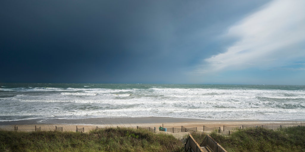


The East Coast is already seeing impacts from the first nor'easter of the fall, bringing coastal flooding, strong winds and pounding surf to millions from New England to the Carolinas over several days.
THE TAKEAWAY
The East Coast is already beginning to see the impacts of a developing nor'easter, with major coastal flooding set to begin Wednesday night from New Jersey to the Virginia Tidewater. All told, millions from New England to the Carolinas will experience days of coastal flooding, strong winds and pounding surf through the weekend.
The system that will become the first nor'easter of the season is set to emerge off the Mid-Atlantic coast between Thursday and Friday before charging towards the heavily populated Northeast.
TIMELINE: HERE'S WHERE AND WHEN MAJOR US CITIES WILL SEE IMPACTS FROM THE DEVELOPING NOR'EASTER
The coastal flood risk will increase throughout the workweek from North Carolina's Outer banks to New England as strong northeasterly winds develop across the offshore and coastal waters, producing powerful wind gusts.
OUTER BANKS FIRST IN LINE FOR DEVELOPING NOR’EASTER AS DANGEROUS IMPACTS BEGIN WEDNESDAY
Seas will rise rapidly, creating heavy surf and dangerous, battering waves along exposed beaches.
According to the FOX Forecast Center, persistent onshore winds will remain locked in through multiple high tide cycles, allowing waves to relentlessly pound the base of coastal dunes.
Significant beach erosion and dune scarping will develop from the Outer Banks through the Mid-Atlantic and Long Island as the surface low-pressure system forms.
Minor to locally moderate coastal flooding will be possible during high tides, especially in low-lying coastal areas like Highway 12 in the North Carolina Outer Banks.
Sea rise could be anywhere from 2 to 3 feet, the FOX Forecast Center said.
FULL MOON COULD WORSEN NOR’EASTER FLOODING ALONG EAST COAST — HERE ARE 5 PLACES TO WATCH
Heading into Thursday, things shift as the surface low pressure system centralizes and strengthens off the Southeast coast and onshore winds expand and intensify.
Widespread tidal flooding will be possible as water becomes unable to drain during low tides and gets trapped in back bays and low-lying areas along the coast.
Some places could even see major flooding, with the FOX Forecast Center saying some of the worst flooding could happen in coastal Maryland and Virginia.
Rain and winds are also predicted to become an issue at this point, with wind gusts between 40 and 50 mph in some coastal areas, pushing ocean water inland.
NOR'EASTER LIVE TRACKER: FUTURE RADAR, WINDS, STORM SURGE, RAIN AND ALERTS
Days of these continuous pounding waves will severely impact beaches. Dune washouts, overwashes and damage to oceanfront boardwalks or coastal infrastructure are increasingly likely across Mid-Atlantic and Long Island beaches.
New England should start seeing rain at this stage, with a Level 1 out of 4 flood threat in effect for Boston, and parts of Rhode Island.
Beginning Saturday, the nor'easter really becomes prominent as the center of the low pressure system moves toward the Interstate 95 corridor and New England.
WILL THE MONSTER NOR'EASTER CANCEL YOUR WEEKEND PLANS? HERE'S WHAT TO KNOW
As the strengthening system tracks into or near New England, the strongest pressure gradient will impact the region, including Boston.
The exact track is still not certain, with some models pushing the low toward Boston, while others show the low pressure closer to New Jersey and Long Island, or even staying offshore. All three scenarios will create more significant impacts in different areas.
If the storm shifts closer to Boston, this could turn the storm into a major weather event, featuring 60 to 70 mph wind gusts, heavy rainfall, major storm surge and significant disruptions to Boston Harbor and the Massachusetts coastline, the FOX Forecast Center said.
If the storm shifts closer to New Jersey or Long Island, the strongest impacts could shift farther south, potentially putting New York City on the fringe of the storm.
Lastly, if the area of low pressure remains offshore, coastal New England could still experience rough surf, elevated tides and breezy conditions, while the heaviest rain and strongest winds remain displaced to the south and east over open water. The FOX Forecast Center said this scenario is the least likely of the three.
THIS NOR’EASTER MAY FOLLOW THE SAME PATH AS SUPERSTORM SANDY, BUT IT’S NOTHING LIKE IT
The FOX Forecast Center said no matter what, winds could gust more than 60 mph as the peak of the storm shifts into southern New England, Massachusetts Bay and the Gulf of Maine.
Dangerous seas, extreme rip currents and massive swells will make ocean waters extremely dangerous.
Rain continues in New England through Sunday. A Level 1 out of 4 flash flood threat stretches from Cape Cod, Rhode Island and coastal Massachusetts, expanding north into parts of New Hampshire. Rain totals will be heaviest along coastal locations.
Impacts are expected to linger through Monday, but as the storm's track becomes more certain, the forecast could change slightly.
Stay with FOX Weather for the latest as we continue to track this developing storm.
The post Powerful nor'easter threatens millions along East Coast with intense coastal flooding, life-threatening surf appeared first on Fox Weather