



Super Typhoon Dolphin barrels towards Asia as it reaches 160 mph winds, equivalent to a Category 5 hurricane
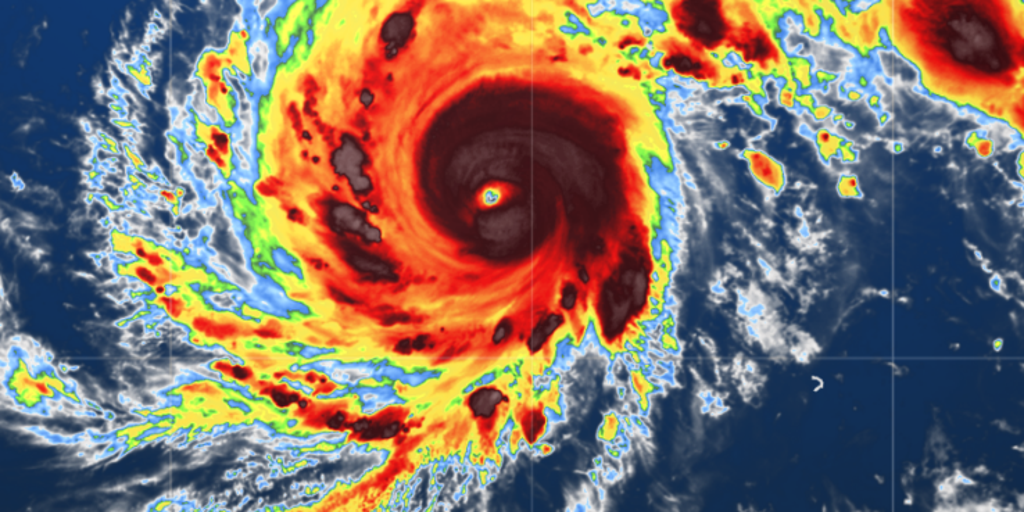


Super Typhoon Dolphin continues to strengthen as it slowly tracks northwest across the Western Pacific toward Asia, with the Joint Typhoon Warning Center reporting sustained winds of 160 mph.
Super Typhoon Dolphin continues to strengthen as it slowly tracks northwest across the Western Pacific toward Asia.
GENEVIEVE CHURNS AS A CATEGORY 2 HURRICANE AS IT BARRELS THROUGH THE EASTERN PACIFIC
While the storm currently poses no immediate threat to land, it remains a powerful Category 5-equivalent super typhoon, with the Joint Typhoon Warning Center reporting sustained winds of 160 mph.
After originating over open waters, the system formed into a tropical depression. According to the FOX Forecast Center, "The storm developed a pinhole eye around 6 to 7 miles wide Tuesday during its explosive growth, which is a sign of very rapid intensification."
The storm intensified dramatically, jumping by 95 mph in a 24-hour period to reach 145 mph by Tuesday afternoon, and is expected to peak at 160 to 170 mph.
Historically, only four Central Pacific storms have tracked far enough west to make landfall in Japan, with two of them occurring during a strong El Niño.
HURRICANE SEASON 2026: THESE ARE THE STORM NAMES YOU'LL SEE THIS SEASON
According to NOAA data, the current El Niño is rapidly intensifying, with 81% potential of a very strong or Super El Niño during October through December.
The FOX Forecast Center will continue to monitor Super Typhoon Dolphin for any potential impacts as it moves west through next week and maintains its structure approaching East Asia.
Stay tuned with FOX Weather for the latest updates.
The post Super Typhoon Dolphin barrels towards Asia as it reaches 160 mph winds, equivalent to a Category 5 hurricane appeared first on Fox Weather