










Post-tropical Isaias still packs a dangerous punch as destructive winds, flooding threaten millions
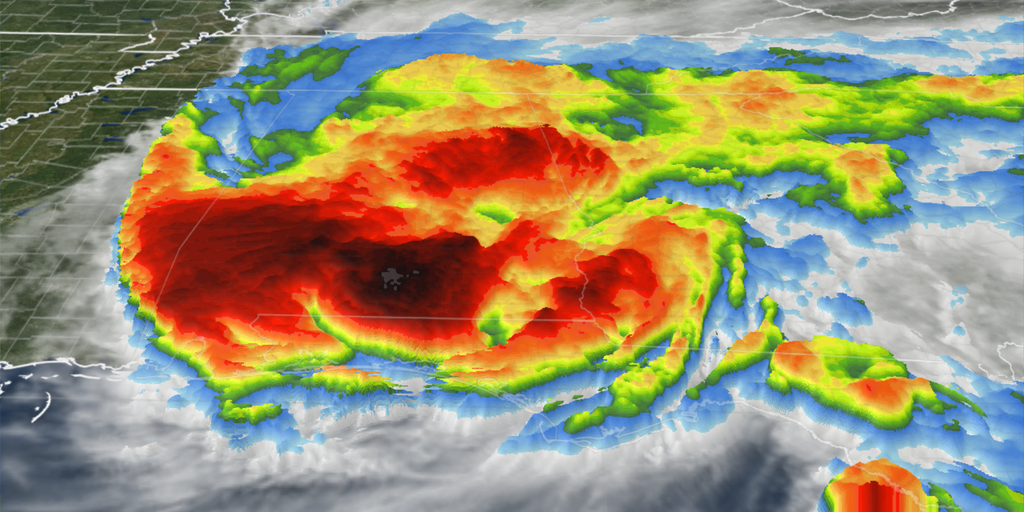


Isaias made landfall Friday as a dangerous Category 2 storm, lashing the northern Gulf Coast with destructive winds and life-threatening storm surge.
Former Hurricane Isaias made landfall Friday as a dangerous Category 2 storm, lashing the northern Gulf Coast with destructive winds and life-threatening storm surge.
ISAIAS THREATENS MORE THAN COASTLINE WITH IMPACTS TO PUSH INLAND ACROSS SOUTH
The powerful storm made landfall at 9:30 p.m. ET near Destin, Florida, with sustained winds of 105 mph and an estimated minimum central pressure of 971 mb as it moved north at 19 mph.
The National Hurricane Center said the storm has since weakened to a post-tropical cyclone, with sustained winds of 90 mph, as it continues to move along the Gulf Coast.
However, the ferocious eyewall winds, life-threatening storm surge and torrential downpours continue to pound the coast as the storm pushes inland.
Reports of significant structural damage are coming in from parts of Florida, where residents reported destructive winds ripping the roof off a hotel in Pensacola.
The National Weather Service (NSW) said many areas experienced hurricane-force winds, with gusts reaching 116 mph at Santa Rosa Sound, Florida, 114 mph at Whiting Field and 102 mph in Pensacola.
Some areas along the Gulf Coast continue to see heavy rainfall, as well, with DeFuniak Springs, Florida, recording 12.46 inches, Mary Esther receiving 8.04 inches and Fort Walton Beach seeing 7.69 inches.
Officials are also reporting rising water levels along the coast, with levels increasing around Panama City and Apalachicola, Florida.
Meanwhile, in Panama City Beach, Florida, water levels recently reached 5.4 feet above the average high tide level, indicating significant coastal flooding.
A Flash Flood Emergency was issued Friday night for Fort Walton Beach and Destin, Florida, amid the threat of life-threatening flooding.
The Storm Prediction Center has issued a Tornado Watch through 6 a.m. ET (5 a.m. CT) for the Florida Panhandle and most of south Georgia.
Power outages are skyrocketing as intense winds bring down trees and topple utility poles across the Gulf Coast.
As of 1:30 a.m., over 431,300 customers in Florida were without power, while more than 262,430 customers in Alabama and 37,700 in Georgia also lost electricity.
In response, FEMA announced that federal disaster assistance is available for Florida and Alabama residents.
Isaias was previously a Category 3 hurricane, but the dangerous storm slightly weakened to a Category 2 before landfall.
Now, hours after landfall, the storm has weakened to a post-tropical cyclone, but that doesn't mean impacts are over.
More than 30 million people across Florida, Alabama, Mississippi, Louisiana and Georgia are expected to experience the worst of Isaias' impacts, while rain from the storm’s remnants will spread across more than 15 states in the eastern U.S. after landfall this weekend.
This story is developing. Check back frequently for updates.
The post Post-tropical Isaias still packs a dangerous punch as destructive winds, flooding threaten millions appeared first on Fox Weather