









How 2 satellites use precise ocean measurements to reveal what could fuel hurricanes during El Niño
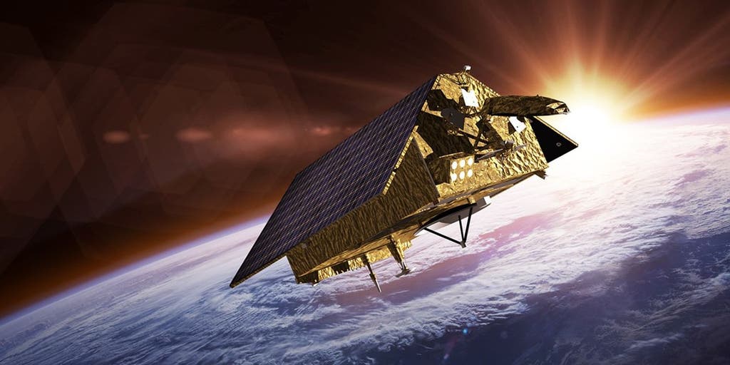

NASA’s Sentinel-6 satellites are tracking ocean conditions during El Niño by measuring sea-surface height, wave size, and wind speed—data that helps scientists understand storm development and improve hurricane forecasts.
THE TAKEAWAY
From orbit, two satellites are tracking the emerging Super El Niño, collecting precise data that can improve hurricane forecasts and protect infrastructure.
As part of a collaborative effort between NASA and its European Space partners, the Sentinel-6B satellite was launched in November, and now flies just 30 seconds behind its predecessor and twin, Sentinel-6 Michael Freilich.
TOXIC RED TIDE DETECTED ALONG TEXAS COASTLINE — HERE’S HOW IT CAN AFFECT YOUR HEALTH
Amid a developing Super El Niño that NOAA said could rank among the strongest on record, NASA’s Sentinel-6/Jason-CS program uses the Sentinel-6 Michael Freilich and Sentinel-6B satellites to measure sea-surface height and monitor ocean conditions — data that can help predict storm intensity.
STRENGTHENING EL NIÑO COULD SHAKE UP FALL WEATHER ACROSS THE US - HERE’S WHAT TO EXPECT
According to NASA, the satellites are the latest in a series of ocean-observing radar missions that have continuously monitored Earth’s changing seas since the early 1990s.
These satellites not only help track the current El Niño, but also provide data for more accurate hurricane forecasts — two efforts that go hand in hand.
El Niño is a periodic warming of the tropical Pacific Ocean that can fuel hurricane activity there while generally suppressing Atlantic activity. Its effects on global weather patterns have been on display throughout this hurricane season.
HURRICANE SWELLS REVEAL FORGOTTEN HISTORY BENEATH ICONIC CALIFORNIA BEACH
Like many hurricane seasons before it, this season has kept satellites busy tracking tropical systems in the Pacific.
According to NASA, on July 15, Sentinel-6B began delivering low-latency data to scientists that could be used for forecast predictions and, eventually relied on by forecasters, eventually could in turn into life-saving statistics.
Depending on a storm’s projected threat, satellite data can prompt federal and state agencies to prepare for its arrival. From sandbags and emergency supplies to warnings and evacuations, this information is critical to early response efforts that protect lives and property.
LOCAL EMERGENCY DECLARED IN CALIFORNIA BEACH CITY TO STABILIZE COASTAL BLUFFS AHEAD OF SUPER EL NIÑO
"Hurricanes have been known to speed up quickly at the last moment, so the window in which to decide what to do is short," Deirdre Byrne, an oceanographer and altimetry expert with the National Oceanic and Atmospheric Administration (NOAA), said. "The goal is to forecast how much and how rapidly intensification will happen so that officials can make the right calls."
According to NASA, each satellite uses a radar altimeter to measure sea-surface height, wave size and wind speed. The instrument sends thousands of radar pulses per second toward the ocean, reflecting off wave crests and troughs.
Variations in ocean height reveal differences in heat content because warmer water expands, helping scientists predict how quickly hurricanes may intensify.
Each satellite is also equipped with an instrument called the Global Navigation Satellite System – Radio Occultation, which gathers all necessary atmospheric data like humidity, pressure and temperature.
These satellites are the latest evolution of a program that has monitored the world’s oceans from space for decades. The record began with the TOPEX/Poseidon mission, which launched in 1992.
Today, Sentinel-6 Michael Freilich serves as the primary reference satellite for global sea-level measurements. Its twin, Sentinel-6B, launched in November 2025 and is extending the program’s long-term record of Earth’s changing seas.
The post How 2 satellites use precise ocean measurements to reveal what could fuel hurricanes during El Niño appeared first on Fox Weather