

 Apple TV + F1")

 Alexa+ Free with Prime get Nikki")


Flooding and avalanche threat grows as atmospheric river continues across the Pacific Northwest
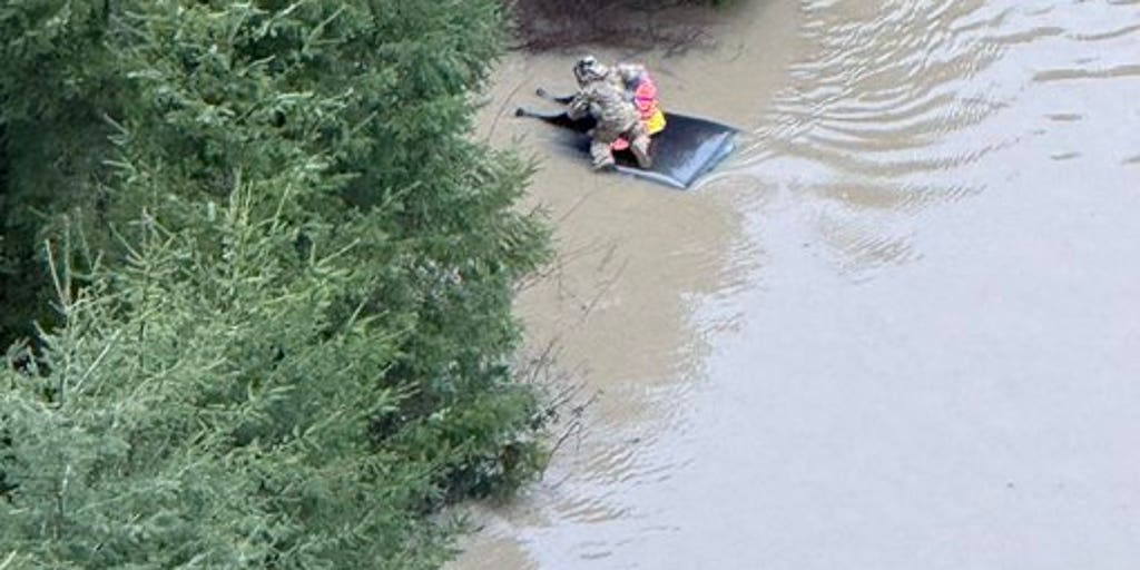
A powerful ongoing atmospheric river is moving across the Pacific Northwest, increasing the risk of flash flooding and avalanches. This comes just days after a storm system caused torrential rain and feet of snow to fall in Washington, Oregon, Idaho and Montana.
A powerful ongoing atmospheric river is moving across the Pacific Northwest, increasing the risk of flash flooding and avalanches.
PACIFIC NORTHWEST FACES RENEWED FLOOD THREAT DUE TO ATMOSPHERIC RIVER
This comes just days after a storm system caused torrential rain and feet of snow to fall in Washington, Oregon, Idaho and Montana.
More than 87,000 customers lost power across Washington and Idaho as strong winds slammed the region.
Officials reported that one person in Washington was killed when a tree toppled onto their car.
According to the FOX Forecast Center, the atmospheric river, fed by moisture originating near Hawaii, will continue as a low-pressure system in the Gulf of Alaska fuels the event.
This time, the greatest flash flood risk is expected around Seattle and along the northern Washington coast.
Multiple rounds of rain are forecast to move into the coastal Washington region. Widespread rainfall totals of 3 to 5 inches are expected by Friday evening with localized amounts of 5 to 8 inches, especially in higher terrain.
Since many of these areas are still saturated from last week’s storms, a Level 1 out of 4 flash flood risk will remain in place through the end of the week.
Flood Watches have been issued for the Seattle metro area, northern Washington and the Olympic Mountains. These watches will remain in effect through Friday afternoon as the heavy rain combined with the snowmelt may increase the risk of flooding, particularly along rivers, including the Skokomish River.
DECEMBER '25: FEDERAL EMERGENCY DECLARED AS HISTORIC FLOODING SWAMPS WASHINGTON STATE
Snow levels are expected to stay high, around 8,000 feet, allowing for the rain to accelerate snowmelt and an increase in runoff. This will raise the risk of flooding and avalanches.
As for right now, the western slopes of the Cascade Mountains are under a considerable avalanche risk, which is forecast to increase to a high risk in the coming days.
7 FACTS YOU SHOULD KNOW ABOUT FLASH FLOODS
Overall, most of the region will remain above average in precipitation through the end of March.
Stay with FOX Weather for the latest on the atmospheric river.
The post Flooding and avalanche threat grows as atmospheric river continues across the Pacific Northwest appeared first on Fox Weather


