








Waterlogged Midwest facing intense flooding through final weekend of summer as severe storms lash region
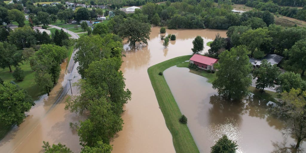


The weeklong firehose of storms aimed at parts of the Midwest, Plains and Ohio Valley will extend through next Monday, putting millions at risk of flash flooding as thunderstorms repeatedly track over the same corridor.
THE TAKEAWAY
The week-long firehose of storms aimed at parts of the Midwest, Plains and Ohio Valley will extend through the weekend into Monday, putting millions at risk of flash flooding as thunderstorms repeatedly track over the same corridor.
NOAA's Weather Prediction Center (WPC) has issued a Level 2 out of 4 flash flood threat for parts of the Midwest through Monday. A widespread 3 to 5 inches of rain could still fall across the region, including Chicago, with some localized areas potentially seeing 5 to 8 inches.
KNOW YOUR FLOOD TERMINOLOGY: WHAT FLOOD WATCHES, WARNINGS AND EMERGENCIES REALLY MEAN
Before then, with inches of rain already falling this week across Illinois, Iowa and Indiana, more rain expected on Saturday will potentially create dangerous flash flooding.
On Saturday, a Level 3 out of 4 flash flood risk is in effect across eastern Iowa, northern Illinois and far northwestern Indiana, including the Chicago metro area, where an additional 2 to 3 inches of rain or more could fall through Monday.
Early Saturday morning, a ground stop was issued at Chicago O'Hare Airport due to thunderstorms in the area.
Some cities, like Linn Grove, Indiana and Bluffton, Indiana have already seen over 8.5 inches of rain since Wednesday. This means the grounds are already saturated which makes the flood threat much more serious.
Neighborhoods in Bluffton, Indiana, 30 miles south of Fort Wayne, flooded through the day Thursday, prompting emergency sandbagging, according to the director of the Wells County Emergency Management Agency.
Photos posted by county officials appeared to show the nearby Wabash River overtopping its banks in some places, washing out several roads.
The initial rounds of storms began at the beginning of the week, bringing flooding to parts of Western Iowa. Des Moines and Omaha have both picked up more than 3 inches of rain since Monday.
Storms are firing along a stalled front draped over eastern Kansas, Nebraska, Iowa, and Illinois, around the western and northern edge of a persistent heat dome that has produced the warmest start to September for many states across the South and creating the week-long rainy pattern.
These storms are filled with deep tropical moisture from the Southwest and the Gulf capable of producing intense rain rates.
The strongest storms will shift south on Saturday, covering Des Moines and Chicago, as well as northern Illinois, flood-stricken northern Indiana and northwestern Ohio.
The core of flood threat is expected to move eastward through the weekend across the Ohio Valley and into the Northeast.
The post Waterlogged Midwest facing intense flooding through final weekend of summer as severe storms lash region appeared first on Fox Weather