

 Classic designer bags")


 Summer of Soccer")


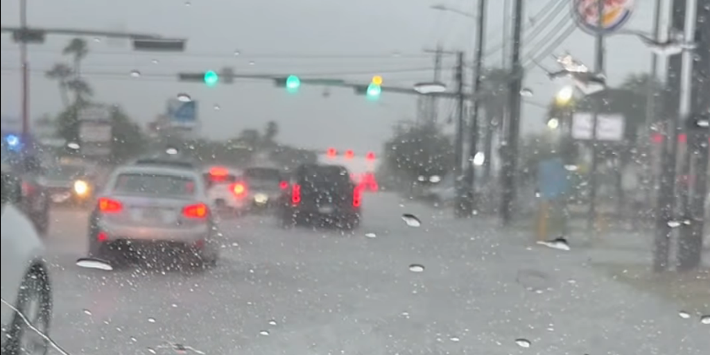
Life-threatening flooding looms for millions across the South as tropical disturbance creeps up Texas coast
Confidence continues to grow for days of heavy rain to soak the South for much of the upcoming week, with flash flooding putting millions at risk from Texas to Georgia.
Confidence continues to grow for days of heavy rain to soak the South for much of the upcoming week, with flash flooding putting millions at risk from Texas to Georgia.
As of earlier this morning, the Burleson County Sheriff's dispatch reported a total of five cars stranded due to high water. All occupants were rescued, and no injuries were reported.
That said, the National Weather Service has upgraded portions of the region to a Level 3 out of 4 flood threat through Thursday, with widespread and locally catastrophic flooding expected over the coming days.
HOW HIGH PRESSURE AND LOW PRESSURE DRIVE THE WEATHER
Deep tropical moisture surging northward will interact with a strong cold front dropping south into the region beginning Sunday. As the front drifts south, it will come to a halt by midweek with daily showers and thunderstorms redeveloping along the boundary as plenty of instability remains available.
At the same time, an upper-level area of circulation — some of which is the ghost of former Tropical Storm Cristina from the eastern Pacific — will move north out of Mexico while tapping into immense Gulf moisture.
With moisture values nearing record territory, slow-moving thunderstorms are expected to ride north off the Gulf as the disturbance tracks into Texas.
While the exact track of the system is unknown, the National Hurricane Center has placed an Area to Watch in the northwestern Gulf.
Although the circulation remains over land in northeastern Mexico, there is a low chance that the center reemerges over the Gulf by midweek as it interacts with the aforementioned front.
DEW POINT VS. HUMIDITY: WHICH ONE IS A BETTER MEASURE OF HOW MUGGY THE AIR FEELS?
While the chance of Tropical Storm Arthur, or even a depression, forming remains very low, the dangerous flood threat stays the same across the South.
Pacific and Gulf moisture teaming up as a firehose across the South will pose a mounting risk along the Texas coastline, with places like Houston and Corpus Christi under a Level 2 out of 4 threat through Tuesday.
HERE'S HOW WEATHER WILL IMPACT THE 2026 FIFA WORLD CUP
In fact, much of South Texas and into Louisiana is under Flood Watches, and this is not even for the rain associated with the tropical disturbance or Area to Watch.
Depending on the track and timing of the potent area of spin, we may still be tracking flash flooding through Friday, as some models show the system causing major impacts in the South into next weekend, according to the FOX Forecast Center.
Regardless, even if the system never achieves tropical status, it may be an extremely dangerous flood threat in locations from Corpus Christi to Houston and into Northern Louisiana.
The post Life-threatening flooding looms for millions across the South as tropical disturbance creeps up Texas coast appeared first on Fox Weather


