


 Apple TV + F1")

 Alexa+ Free with Prime get Nikki")


El Niño and hurricane season: What it means and how similar circumstances have played out
The tropical Pacific trends toward a stronger El Niño—a change with significant implications for the 2026 Atlantic hurricane season. Here's a look at what that means, and how similar circumstances since 1990 played out.
MIAMI, Flo. – A major shift in global climate patterns is underway, as the tropical Pacific trends toward a stronger El Niño and away from La Niña—a change with significant implications for the 2026 Atlantic hurricane season.
In most cases, a strong El Niño acts to suppress hurricane activity by increasing wind shear in the atmosphere over the Atlantic Ocean, which can disrupt developing storms and make it harder for hurricanes to organize and strengthen.
'SUPER EL NIÑO' BREWING AS LA NIÑA FADES AHEAD OF PEAK HURRICANE SEASON
Given the forecast for this year, this hurricane season may not be so straightforward. Although in an El Niño, the atmosphere acts to suppress developing storms, the threat of dangerous hurricanes is still very real.
Sea surface temperatures in the Atlantic remain near or slightly above average, which provides fuel for storms, setting the stage for a battle between unfavorable wind conditions caused by El Niño and the warmer ocean waters that strengthen brewing storms.
In the 2023 hurricane season, during a similar El Niño set up, record warm sea surface temperatures offset the traditional negative impacts from El Niño. Though El Niño informs long-range forecasts to better understand the atmospheric environment that plays a major role in the formation of the storms that are remembered for decades, the hurricane season is defined by much more than just El Niño or La Niña.
Even in years with a strong El Niño, the risk is never zero. These patterns may bring fewer storms overall—but it only takes one monster hurricane to leave a lasting mark for years to come.
Since 1990, there have been seven years with a comparable El Niño to what some of the more aggressive forecasts are suggesting for 2026. These were years with either a borderline strong El Niño or events that pushed into "super" El Niño territory. Those years were 1991, 1994, 1997, 2002, 2009, 2015 and 2023.
On average, those seasons produced 11 named storms, four hurricanes and two major hurricanes (Category 3+).
That is below the long-term Atlantic averages of 14 named storms, seven hurricanes and three major hurricanes.
The takeaway is simple. Even during a "Strong El Niño," when overall activity is reduced, it only takes one storm to create significant impacts.
The most impactful storm of the 1991 hurricane season remains a significant meteorological event due to its rare formation.
HOW HIGH PRESSURE AND LOW PRESSURE DRIVE THE WEATHER
A high-pressure system, a North Atlantic cold front and the remnants of Hurricane Grace merged into a single, massive storm to create "The Perfect Storm."
The storm was able to intensify over the warm waters of the Gulf and take an unexpected turn back toward the U.S. coast.
Although the storm never made landfall in the U.S., it generated hurricane-force winds and massive waves that decimated coastal New England, killing six crew members from the fishing vessel Andrea Gail, which would later go on to inspire the Hollywood film "The Perfect Storm" starring George Clooney.
Despite hurricane strength, the storm was never officially named.
Though Tropical Storm Alberto never, in meteorological terms, met the necessary strength to be considered a hurricane, the damage it inflicted on the southeastern U.S. remains a benchmark disaster.
Primarily remembered for the storm's "stalling" behavior, the storm made landfalls and, as a decaying system, hovered over Georgia and Alabama for days, dumping upwards of 20 inches of rain in some areas.
The storm triggered record-breaking crests across many river basins, resulting in extreme flooding across parts of the region. In the end, the widespread inundation left 33 dead.
Though the 1977 hurricane season was considered a quiet year, Hurricane Danny made landfall in southeast Louisiana.
Danny made a second landfall near Mobile Bay, bringing extreme rain to Alabama, with over 3 feet falling in Dauphin Island.
Only eight storms formed during the 1997 Atlantic hurricane season; the other seven did not have any land impacts.
Back-to-back storms made the 2002 hurricane season one to remember, especially in Louisiana.
Hurricane Isidore was a powerful Category 3 storm at its peak, bringing significant impacts to Jamaica, Cuba and the Yucatán Peninsula. By the time it approached Louisiana, it had weakened to a tropical storm, but still produced heavy rain and flooding across the region.
Just days later, Hurricane Lili followed a similar path. Lili rapidly intensified into a Category 4 hurricane over the then-named Gulf of Mexico before weakening ahead of landfall, ultimately landing in Louisiana as a Category 1 hurricane.
Remarkably, Lili made landfall only seven days after Isidore impacted the same general area.
Combined, these two storms caused widespread damage across parts of the Caribbean and the Deep South, and were responsible for 37 fatalities.
With only nine named storms, the 2009 Atlantic hurricane season was relatively quiet.
One notable system that year was Hurricane Ida, which briefly reached Category 2 strength as it moved off the coast of the U.S., never making landfall as an official tropical cyclone.
However, Ida's story did not end there. The remnants of the storm transitioned into a powerful nor'easter, later dubbed "Nor'Ida."
The system went on to produce impacts across the Southeast and East Coast, with storm surge levels, rainfall and coastal impacts comparable to that of a tropical cyclone.
Hurricane Joaquin was a true wildcard.
It stalled and looped over the Bahamas as a powerful Category 4, becoming one of the region’s most damaging storms. While it never made U.S. landfall, it helped trigger historic flooding across the Southeast.
As Joaquin lingered offshore, it funneled deep tropical moisture into the region. At the same time, a non-tropical system and stalled front along the Carolina coast acted like a conveyor belt—lifting that moisture into a relentless "fire hose" of rain.
The result: catastrophic flooding, especially in South Carolina. Columbia and Charleston shattered multi-day rainfall records, with Charleston setting a new wettest October in just four days.
Even without landfall, Joaquin became one of the most impactful weather events of 2015.
The 2023 season defied expectations for a developing El Niño, becoming the Atlantic’s fourth most active on record. Exceptionally warm ocean waters helped offset El Niño’s usual suppressing effects, fueling storm development.
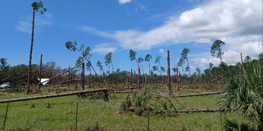
Hurricane Idalia was the season’s standout, rapidly intensifying into a Category 4 before landfall in Florida’s Big Bend.
DRONE VIDEO REVEALS DAMAGE, FLOODING FROM HURRICANE IDALIA LANDFALL NEAR KEATON BEACH
It produced record storm surge from Tampa Bay to the Big Bend and, at the time, became the strongest storm on record to strike the region—until Hurricane Helene surpassed it the following year.
The post El Niño and hurricane season: What it means and how similar circumstances have played out appeared first on Fox Weather


