


 Summer of Soccer")


Deep tropical moisture brings flood threat to Florida despite 0% chance of tropical development
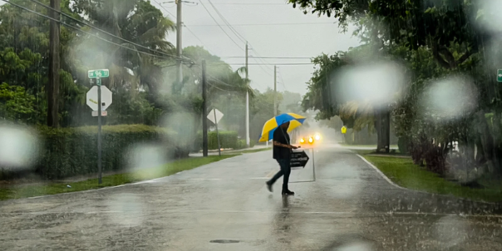
An area of low pressure off the Southeast coast has no chance of tropical development, but it will still funnel deep tropical moisture into Florida, bringing rounds of heavy rain and the potential for localized flooding through Wednesday.
FLORIDA – The Sunshine State is in for a soaking this week. While an area of low pressure off the Southeast coast has no chance of tropical development, it will still funnel deep tropical moisture into Florida, bringing rounds of heavy rain and the potential for localized flooding through Wednesday.
The weak, non-tropical system isn't expected to organize into a named storm, but its impacts will still be felt. As the disturbance interacts with a southward-moving cold front, showers and thunderstorms are expected to become more widespread, raising the risk of minor flooding across parts of Florida.
READY FOR A HUNT? YOU COULD WIN MONEY FOR HUNTING THESE INVASIVE SNAKES DURING ANNUAL CHALLENGE
Meanwhile, a sprawling heat dome is building over the eastern United States. While it's fueling a dangerous heat wave across parts of the Northeast, it's also helping steer the disorganized area of low pressure back to the West.
As this cold front continues pushing south-west across northern Florida, it will tap into the deep tropical moisture already in place over the peninsula. That combination will spark widespread showers and thunderstorms ahead of the front.
WHAT IS A HEAT DOME AND HOW CAN IT AFFECT YOU DURING THE SUMMER MONTHS?
With the lingering storm, though it won't develop into a tropical system, because of the potential for heavy rainfall, parts of Florida are under a Level 1 of 4 risk for flash flooding through Wednesday across Southeast Florida.
Across northern Florida, afternoon pulse storms could trigger sudden damaging winds up to 50 mph and frequent lightning, while tightening winds behind the front elevate the rip current risk along beaches on the north-east coast.
Further south, this moisture influx will break through recent layers of dry Saharan dust. Ahead of the rain, intense afternoon heating will drive heat indices up to 105–110 degrees in urban areas.
As the front slows down and eventually stalls across Central and South Florida, storms may repeatedly move over the same areas, increasing the risk of localized urban flash flooding, especially around Miami and the rest of Southeast Florida.
As the front begins to stall across Central and South Florida, the combination of high tropical moisture and daily sea breezes will likely trigger localized urban flash flooding near Miami and the rest of the Southeast Florida coast.
The post Deep tropical moisture brings flood threat to Florida despite 0% chance of tropical development appeared first on Fox Weather


