



First responders race to reach stranded campers as dangerous Flash Flood Emergency unfolds across Missouri
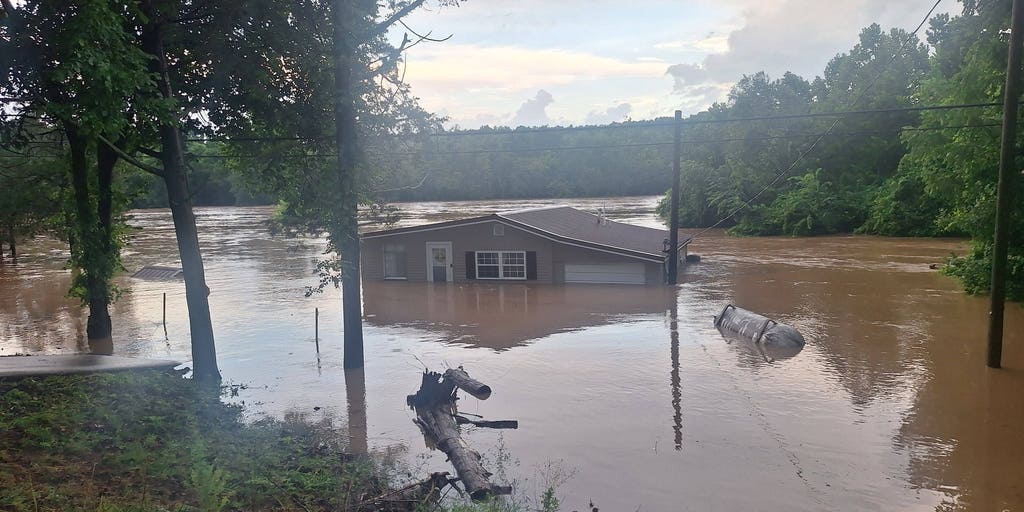


A slow-moving cold front is bringing torrential rain to the Heartland, triggering a life-threatening Flash Flood Emergency across parts of southeastern Missouri early Friday. A broader flash flood threat covers nearly 40 million people across parts of the Ohio and Tennessee valleys Friday.
LESTERVILLE, Mo. — A slow-moving cold front is bringing torrential rain to the Heartland, triggering a life-threatening Flash Flood Emergency across parts of southeastern Missouri early Friday.
A broader flash flood threat covers nearly 40 million people across parts of the Ohio and Tennessee valleys, with more downpours and severe weather expected for the region through the weekend.
The National Weather Service (NWS) urged people in Iron and northeastern Reynolds counties in Missouri to seek higher ground early Friday.
The Fenton Fire Protection District told FOX Weather that rescue crews are on their way to 40 people, including children, stranded at the Black River Lodge in Lesterville.
Others were successfully evacuated from multiple campgrounds along the Black River in Lesterville.
4 DEAD AS FLASH FLOODING SLAMS KENTUCKY, TRIGGERING EMERGENCIES AND EVACUATIONS
Earlier Friday morning, an official at a regional emergency dispatch center in Ellisville, Missouri, told FOX Weather that campers needed rescue at multiple campgrounds in Reynolds and Iron counties. Initial calls indicated some had climbed trees to escape rising floodwaters.
Parts of southeastern Missouri have already picked up at least 12.25 inches of rain since Thursday.
Swiftwater rescue teams were seen operating in Johnson's Shut-Ins State Park in Reynolds County by mid-morning Friday.
WHAT FLASH FLOOD EMERGENCIES REALLY MEAN
Homes were flooded in Annapolis, Missouri, early Friday as creek waters washed over local roads and bridges.
State roads throughout Iron and Reynolds counties remain closed due to flooding.
The Black River at Annapolis has reached a record high and continues to rise, with a crest above 28 feet forecast for Saturday, according to the FOX Forecast Center.
This system is moving across communities where soils are already completely saturated from storms earlier this week and comes on the heels of downpours at the end of June that triggered a deadly Flash Flood Emergency in Kentucky that killed 4 people.
NOAA's Weather Prediction Center (WPC) issued a Level 3 out of 4 risk of flash flooding across most of southeastern Missouri.
A broader Level 2 flood threat covers northern Missouri, central and southern Illinois, central and southern Indiana, central and southern Ohio, Kentucky, Tennessee, West Virginia and southwestern Pennsylvania.
Flash flood threats will extend into next week as the front continues to sag slowly south and east.
Widespread rainfall totals of 1 to 2 inches are expected from southern and central Missouri eastward into West Virginia and northern Tennessee, with up to 3 inches possible across southern Indiana, Kentucky, and Tennessee.
Localized amounts exceeding 3 to 5 inches are possible where storms repeatedly track over the same areas.
In addition to the flash flood threat, severe storms are likely on both Friday and Saturday, with damaging wind gusts exceeding 60 mph as the primary hazard.
"Because soils are already saturated, trees will uproot easily," the FOX Forecast Center said.
Check back for updates on this developing story.
The post First responders race to reach stranded campers as dangerous Flash Flood Emergency unfolds across Missouri appeared first on Fox Weather